Difference between revisions of "Municipality:Västerås"
(New name on a zone) |
(New zones) |
||
| (5 intermediate revisions by the same user not shown) | |||
| Line 5: | Line 5: | ||
|symbol = [[File: Coat of arms of Västerås.png|60px]] | |symbol = [[File: Coat of arms of Västerås.png|60px]] | ||
|symboltext = Coat of arms of Västerås | |symboltext = Coat of arms of Västerås | ||
| − | |country = [[Country: Sweden|Sweden]] [[File: Flag of Sweden.png|x12px | + | |country = [[Country: Sweden|Sweden]] [[File: Flag of Sweden.png|x12px]] |
|region = [[Region: Västmanland|Västmanland]] | |region = [[Region: Västmanland|Västmanland]] | ||
| − | |numberofzones = | + | |numberofzones = 883 |
| − | |maxpph = | + | |maxpph = 4683 |
| − | |updated = | + | |updated = 2022-01-24 |
}} | }} | ||
| − | '''Västerås''' is a [[municipality]] in the [[region]] of [[Region: Västmanland|Västmanland]] in [[Country: Sweden|Sweden]]. The municipality has approximately 156, | + | '''Västerås''' is a [[municipality]] in the [[region]] of [[Region: Västmanland|Västmanland]] in [[Country: Sweden|Sweden]]. The municipality has approximately 156,600 inhabitants and is located in its entirety in the [[province]] Västmanland. |
== Location == | == Location == | ||
| Line 18: | Line 18: | ||
== Urban areas == | == Urban areas == | ||
| − | The urban area [[Västerås]] is the largest with about | + | The urban area [[Västerås]] is the largest with about 128,500 inhabitants and constitutes the municipality's central town. |
Other urban areas in the municipality are [https://en.wikipedia.org/wiki/Barkar%C3%B6 Barkarö], [https://en.wikipedia.org/wiki/Dingtuna Dingtuna], [https://en.wikipedia.org/wiki/Enhagen-Ekbacken Enhagen-Ekbacken], Harkie, [https://en.wikipedia.org/wiki/H%C3%B6k%C3%A5sen Hökåsen], [https://en.wikipedia.org/wiki/Irsta Irsta], [https://en.wikipedia.org/wiki/K%C3%A4rsta_och_Bredsdal Kärsta], Lycksta, Malmen, [https://en.wikipedia.org/wiki/Munga Munga], [https://en.wikipedia.org/wiki/Skultuna Skultuna], [https://en.wikipedia.org/wiki/Tid%C3%B6-Lind%C3%B6 Tidö-Lindö], [https://en.wikipedia.org/wiki/Tillberga Tillberga], [https://en.wikipedia.org/wiki/Tortuna Tortuna] och [https://en.wikipedia.org/wiki/%C3%96rtag%C3%A5rden Örtagården] and part of [https://en.wikipedia.org/wiki/Kvicksund Kvicksund]. | Other urban areas in the municipality are [https://en.wikipedia.org/wiki/Barkar%C3%B6 Barkarö], [https://en.wikipedia.org/wiki/Dingtuna Dingtuna], [https://en.wikipedia.org/wiki/Enhagen-Ekbacken Enhagen-Ekbacken], Harkie, [https://en.wikipedia.org/wiki/H%C3%B6k%C3%A5sen Hökåsen], [https://en.wikipedia.org/wiki/Irsta Irsta], [https://en.wikipedia.org/wiki/K%C3%A4rsta_och_Bredsdal Kärsta], Lycksta, Malmen, [https://en.wikipedia.org/wiki/Munga Munga], [https://en.wikipedia.org/wiki/Skultuna Skultuna], [https://en.wikipedia.org/wiki/Tid%C3%B6-Lind%C3%B6 Tidö-Lindö], [https://en.wikipedia.org/wiki/Tillberga Tillberga], [https://en.wikipedia.org/wiki/Tortuna Tortuna] och [https://en.wikipedia.org/wiki/%C3%96rtag%C3%A5rden Örtagården] and part of [https://en.wikipedia.org/wiki/Kvicksund Kvicksund]. | ||
== Zones == | == Zones == | ||
| − | There are [https://lundkvist.com/?country=se®ion=143&city=V%C3%A4ster%C3%A5s | + | There are [https://lundkvist.com/?country=se®ion=143&city=V%C3%A4ster%C3%A5s 883] [[turf zones]] in the municipality of Västerås, seven of which are counted as [[winner zones]], six [[water zones]], two [[train station zones]], three [[monument zones]], 26 [[holy zones]], 20 [[bridge zones]], three [[castle zones]] and 13 [[ruin zones]]. |
| − | The most taken zone is [[Zone: | + | The most taken zone is [[Zone: Aseaströmmen|Aseaströmmen]] which is located on Stora Torget in central [[Västerås]]. |
Year in parentheses indicates year of creation. | Year in parentheses indicates year of creation. | ||
| Line 32: | Line 32: | ||
* [[Zone: FiskeLasse|FiskeLasse]] ([[2013]]) - [[Round 31]] by [[User: fiskeLasse|fiskeLasse]] | * [[Zone: FiskeLasse|FiskeLasse]] ([[2013]]) - [[Round 31]] by [[User: fiskeLasse|fiskeLasse]] | ||
* [[Zone: mrAcePlace|mrAcePlace]] ([[2020]]) - [[Round 115]] by [[User: mrAce|mrAce]] | * [[Zone: mrAcePlace|mrAcePlace]] ([[2020]]) - [[Round 115]] by [[User: mrAce|mrAce]] | ||
| + | * [[Zone: Skäggfar|Skäggfar]] ([[2021]]) - [[Round 136]] by [[User: skäggfar|skäggfar]] | ||
* [[Zone: Squirrelpark|Squirrelpark]] ([[2015]]) - [[Round 54]] by [[User: squirrel|squirrel]] | * [[Zone: Squirrelpark|Squirrelpark]] ([[2015]]) - [[Round 54]] by [[User: squirrel|squirrel]] | ||
* [[Zone: SquirrelZone|SquirrelZone]] ([[2013]]) - [[Round 41]] by [[User: squirrel|squirrel]] | * [[Zone: SquirrelZone|SquirrelZone]] ([[2013]]) - [[Round 41]] by [[User: squirrel|squirrel]] | ||
| Line 55: | Line 56: | ||
=== [[File: Zontyp07.png|24px]] [[Holy zones]] === | === [[File: Zontyp07.png|24px]] [[Holy zones]] === | ||
| − | * [[Zone: BadChurchZone|BadChurchZone]] ([[2012]]) | + | * [[Zone: BadChurchZone|BadChurchZone]] ([[2012]]) - Formerly called ''BadchurchZone'' |
* [[Zone: BarkChurch|BarkChurch]] ([[2012]]) | * [[Zone: BarkChurch|BarkChurch]] ([[2012]]) | ||
* [[Zone: BigCross|BigCross]] ([[2015]]) | * [[Zone: BigCross|BigCross]] ([[2015]]) | ||
| Line 61: | Line 62: | ||
* [[Zone: ByTheLake|ByTheLake]] ([[2010]]) | * [[Zone: ByTheLake|ByTheLake]] ([[2010]]) | ||
* [[Zone: DaggrosZone|DaggrosZone]] ([[2012]]) | * [[Zone: DaggrosZone|DaggrosZone]] ([[2012]]) | ||
| − | * [[Zone: | + | * [[Zone: DingtunaKyrka|DingtunaKyrka]] ([[2014]]) - Formerly called ''Dingtunakyrka'' |
* [[Zone: DomChurch|DomChurch]] ([[2010]]) | * [[Zone: DomChurch|DomChurch]] ([[2010]]) | ||
* [[Zone: FoldBedZone|FoldBedZone]] ([[2014]]) | * [[Zone: FoldBedZone|FoldBedZone]] ([[2014]]) | ||
| Line 88: | Line 89: | ||
* [[Zone: DuckCreek|DuckCreek]] ([[2013]]) | * [[Zone: DuckCreek|DuckCreek]] ([[2013]]) | ||
* [[Zone: GroveTrain|GroveTrain]] ([[2013]]) | * [[Zone: GroveTrain|GroveTrain]] ([[2013]]) | ||
| − | |||
* [[Zone: HamreCreek|HamreCreek]] ([[2014]]) | * [[Zone: HamreCreek|HamreCreek]] ([[2014]]) | ||
* [[Zone: HarborBridge|HarborBridge]] ([[2012]]) | * [[Zone: HarborBridge|HarborBridge]] ([[2012]]) | ||
| Line 102: | Line 102: | ||
* [[Zone: Svartebro|Svartebro]] ([[2014]]) | * [[Zone: Svartebro|Svartebro]] ([[2014]]) | ||
* [[Zone: Svartåbron|Svartåbron]] ([[2012]]) | * [[Zone: Svartåbron|Svartåbron]] ([[2012]]) | ||
| + | * [[Zone: SödraVåt|SödraVåt]] ([[2021]]) | ||
* [[Zone: WoodyBridge|WoodyBridge]] ([[2012]]) | * [[Zone: WoodyBridge|WoodyBridge]] ([[2012]]) | ||
| Line 125: | Line 126: | ||
=== Other zones === | === Other zones === | ||
| + | * [[Zone: AlnusLitore|AlnusLitore]] ([[2014]]) - Formerly called ''FungusForest'' and before that ''FugusForest'' | ||
| + | * [[Zone: AnkarZone|AnkarZone]] ([[2014]]) - Formerly called ''Ankarzone'' | ||
| + | * [[Zone: BjörnöMagasin|BjörnöMagasin]] ([[2015]]) - Formerly called ''Båtallén'' and was located elsewhere. | ||
| + | * [[Zone: Bonanza2012s|Bonanza2012s]] ([[2010]]) - Formerly called ''MarinaZone'' | ||
| + | * [[Zone: BärbyHage|BärbyHage]] ([[2015]]) - Formerly called ''Hustahöjden'' | ||
| + | * [[Zone: CanUDunk|CanUDunk]] ([[2013]]) - Formerly called ''CanUdunk'' | ||
| + | * [[Zone: Djurfoder|Djurfoder]] ([[2012]]) - Formerly called ''OldHeat'' | ||
| + | * [[Zone: Ekberga|Ekberga]] ([[2013]]) - Formerly called ''EkbergaZone'' | ||
| + | * [[Zone: Eskadern|Eskadern]] ([[2014]]) - Formerly called ''Eskaden'' | ||
| + | * [[Zone: Flotten|Flotten]] ([[2014]]) - The 500<sup>th</sup> [[turf zone]] in the municipality. | ||
| + | * [[Zone: FyrPåPir|FyrPåPir]] ([[2014]]) - Formerly called ''PiriPir'' and was located elsewhere. | ||
| + | * [[Zone: Gångholmen|Gångholmen]] ([[2018]]) - Formerly called ''Åkerö'' | ||
| + | * [[Zone: Hagaparkhage|Hagaparkhage]] ([[2018]]) - Formerly called ''Bankett2018'' | ||
| + | * [[Zone: HakunaMatata|HakunaMatata]] ([[2017]]) - Formerly called ''GeijRune'' | ||
| + | * [[Zone: HawkRidgeZone|HawkRidgeZone]] ([[2013]]) - Formerly called ''HawkridgeZone'' | ||
| + | * [[Zone: Hultet|Hultet]] ([[2018]]) - Formerly called ''Skogstorpet'' | ||
| + | * [[Zone: IrstaGäddväg|IrstaGäddväg]] ([[2015]]) - Formerly called ''Irstagäddväg'' | ||
| + | * [[Zone: JagOchÅn|JagOchÅn]] ([[2019]]) - The 800<sup>th</sup> [[turf zone]] in the municipality. | ||
| + | * [[Zone: KanikLundby|KanikLundby]] ([[2015]]) - Formerly called ''Skosspåret'' | ||
| + | * [[Zone: Katrinelunden|Katrinelunden]] ([[2014]]) - Formerly called ''KatrineLunden'' | ||
| + | * [[Zone: Krumeluren|Krumeluren]] ([[2012]]) - Formerly called ''SilverZone'' | ||
| + | * [[Zone: KustaGård|KustaGård]] ([[2016]]) - Formerly called ''Ångsjön'' and was located elsewhere. | ||
| + | * [[Zone: Kyrkbåten|Kyrkbåten]] ([[2015]]) - Named for a while ''Båtflykting'' and was located elsewhere. | ||
| + | * [[Zone: Lybeck|Lybeck]] ([[2016]]) - Formerly called ''HarkieHamn'' and was located elsewhere. | ||
| + | * [[Zone: LötsGamlaTomt|LötsGamlaTomt]] ([[2018]]) - Formerly called ''LötsGamlaBro'' | ||
| + | * [[Zone: MiddlePark|MiddlePark]] ([[2011]]) - The 50<sup>th</sup> [[turf zone]] in the municipality. | ||
| + | * [[Zone: MissPiggyZone|MissPiggyZone]] ([[2011]]) - Formerly called ''PiggyZone''. Named for a while ''GrisPåRymmen'' and was located elsewhere. | ||
| + | * [[Zone: Narvazon|Narvazon]] ([[2017]]) - Formerly called ''NarvaZon'' | ||
| + | * [[Zone: NorthVillage|NorthVillage]] ([[2012]]) - The 100<sup>th</sup> [[turf zone]] in the municipality. | ||
| + | * [[Zone: Orientalen|Orientalen]] ([[2017]]) - Formerly called ''Lusseturf2017'' | ||
| + | * [[Zone: RönnbyTop|RönnbyTop]] ([[2013]]) - Formerly called ''RonnbyTop'' | ||
| + | * [[Zone: Skattesmitare|Skattesmitare]] ([[2012]]) - Formerly called ''TaxZone'' and was located elsewhere. | ||
| + | * [[Zone: SlingaISkog|SlingaISkog]] ([[2014]]) - Formerly called ''Skogslingan'' and before that ''VallbyWoods'' | ||
| + | * [[Zone: Stålverkszon|Stålverkszon]] ([[2015]]) - Formerly called ''Stålverkzon'' | ||
| + | * [[Zone: Svalgången|Svalgången]] ([[2017]]) - The 750<sup>th</sup> [[turf zone]] in the municipality. | ||
| + | * [[Zone: Sätragrill|Sätragrill]] ([[2017]]) - Formerly called ''EriksSkogborg'' and before that ''EriksSkogBorg'' | ||
| + | * [[Zone: TillbergaPath|TillbergaPath]] ([[2014]]) - Formerly called ''Tillbergapath'' | ||
| + | * [[Zone: TypKlintaIP|TypKlintaIP]] ([[2012]]) - Formerly called ''KlintaIP'' | ||
| + | * [[Zone: Vallbybroa|Vallbybroa]] ([[2014]]) - Formerly called ''VallbyBroa'' | ||
| + | * [[Zone: Vikingagraven|Vikingagraven]] ([[2014]]) - Formerly called ''IngenGrav'' and before that ''Vikingagraven'' | ||
| + | * [[Zone: ÅkerPåStig|ÅkerPåStig]] ([[2020]]) - Formerly called ''Åkerpåfart'' | ||
| + | * [[Zone: ÅshagenZone|ÅshagenZone]] ([[2013]]) - Formerly called ''AshagenZone'' | ||
| + | * [[Zone: Ödlegraven|Ödlegraven]] ([[2020]]) - Formerly called ''MalmaPath'' | ||
| − | ''Updated: | + | ''Updated: 2022-01-24'' |
== Gallery == | == Gallery == | ||
| Line 136: | Line 180: | ||
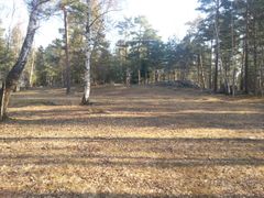
Silverhill.jpg|The zone [[Zone: SilverHill|SilverHill]]. | Silverhill.jpg|The zone [[Zone: SilverHill|SilverHill]]. | ||
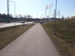
Cranebuilder.jpg|The zone [[Zone: CraneBuilder|CraneBuilder]]. | Cranebuilder.jpg|The zone [[Zone: CraneBuilder|CraneBuilder]]. | ||
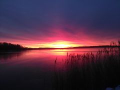
| − | Squirrelzone by | + | Squirrelzone by Mörkret.jpg|View from the zone [[Zone: SquirrelZone|SquirrelZone]]. |
</gallery> | </gallery> | ||
Latest revision as of 18:42, 24 January 2022
| Västerås | |
|---|---|
 | |
 Coat of arms of Västerås | |
| Country | Sweden |
| Region | Västmanland |
| Number of zones | 883 |
| Maximum PPH | 4683 |
| Last updated | 2022-01-24 |
Västerås is a municipality in the region of Västmanland in Sweden. The municipality has approximately 156,600 inhabitants and is located in its entirety in the province Västmanland.
Contents
Location[edit]
The municipality is located in the southern parts of the province Västmanland on the northern shore of Lake Mälaren. Västerås municipality borders the municipalities Hallstahammar and Surahammar in the west and Sala in the north, all in Västmanland län. The municipality also borders Enköping in Uppsala län in the east and has a maritime border with Strängnäs and Eskilstuna in Södermanlands län in the south and to Kungsör in Västmanlands län in the southwest.
Urban areas[edit]
The urban area Västerås is the largest with about 128,500 inhabitants and constitutes the municipality's central town.
Other urban areas in the municipality are Barkarö, Dingtuna, Enhagen-Ekbacken, Harkie, Hökåsen, Irsta, Kärsta, Lycksta, Malmen, Munga, Skultuna, Tidö-Lindö, Tillberga, Tortuna och Örtagården and part of Kvicksund.
Zones[edit]
There are 883 turf zones in the municipality of Västerås, seven of which are counted as winner zones, six water zones, two train station zones, three monument zones, 26 holy zones, 20 bridge zones, three castle zones and 13 ruin zones.
The most taken zone is Aseaströmmen which is located on Stora Torget in central Västerås.
Year in parentheses indicates year of creation.
 Winner zones[edit]
- FiskeLasse (2013) - Round 31 by fiskeLasse
- mrAcePlace (2020) - Round 115 by mrAce
- Skäggfar (2021) - Round 136 by skäggfar
- Squirrelpark (2015) - Round 54 by squirrel
- SquirrelZone (2013) - Round 41 by squirrel
- StonesZone (2012) - Round 27 by Stone
- SunYourZone (2012) - Round 20 by SunYour
 Water zones[edit]
- FramnäsBad (2014)
- HökGropen (2017)
- LögaStrandbad (2014)
- OtterInn (2012)
- SmåttVått (2014)
- Westwater (2011)
 Train station zones[edit]
 Monument zones[edit]
 Holy zones[edit]
- BadChurchZone (2012) - Formerly called BadchurchZone
- BarkChurch (2012)
- BigCross (2015)
- BjörkstaKyrka (2015)
- ByTheLake (2010)
- DaggrosZone (2012)
- DingtunaKyrka (2014) - Formerly called Dingtunakyrka
- DomChurch (2010)
- FoldBedZone (2014)
- Gravklockan (2012)
- Hovdestalund (2014)
- HubboKyrka (2014)
- InteIKyrkan (2015)
- IrstaChurch (2013)
- KärrboKyrka (2016)
- Lillkyrka (2020)
- LundbyChurch (2014)
- NyaRytterne (2015)
- PotChurch (2014)
- Romfartuna (2016)
- SkerikeKyrka (2016)
- SkulChurch (2014)
- SyrianZone (2012)
- Tillberga (2016)
- TomasZone (2012)
- TortunaChurch (2013)
 Bridge zones[edit]
- Bassängbron (2015)
- BearBridge (2012)
- BridgeHamer (2014)
- DuckCreek (2013)
- GroveTrain (2013)
- HamreCreek (2014)
- HarborBridge (2012)
- KoloniZone (2012)
- Länsgränsen (2016)
- NorthTrail (2013)
- Pilotbroa (2014) - Formerly called PilotBroa
- PowerZone (2010)
- Råbybron (2013)
- SkullBridge (2016)
- SkultunaBruk (2016)
- SpeedBump (2012)
- Svartebro (2014)
- Svartåbron (2012)
- SödraVåt (2021)
- WoodyBridge (2012)
 Castle zones[edit]
- EngsöSlott (2014)
- TidöSlott (2014)
- WestCastle (2013)
 Ruin zones[edit]
- AnundsHeap (2010)
- Dyboborgzone (2014)
- EkebyBorg (2016)
- Grytahögen (2013)
- HubboRunsten (2017)
- Jättegraven (2012)
- LabyrinTomb (2014)
- LillaRytterne (2015)
- Solviksborg (2016)
- SorbySkans (2014)
- StGertruds (2012)
- StoraRytterne (2015)
- Önstensborg (2012)
Other zones[edit]
- AlnusLitore (2014) - Formerly called FungusForest and before that FugusForest
- AnkarZone (2014) - Formerly called Ankarzone
- BjörnöMagasin (2015) - Formerly called Båtallén and was located elsewhere.
- Bonanza2012s (2010) - Formerly called MarinaZone
- BärbyHage (2015) - Formerly called Hustahöjden
- CanUDunk (2013) - Formerly called CanUdunk
- Djurfoder (2012) - Formerly called OldHeat
- Ekberga (2013) - Formerly called EkbergaZone
- Eskadern (2014) - Formerly called Eskaden
- Flotten (2014) - The 500th turf zone in the municipality.
- FyrPåPir (2014) - Formerly called PiriPir and was located elsewhere.
- Gångholmen (2018) - Formerly called Åkerö
- Hagaparkhage (2018) - Formerly called Bankett2018
- HakunaMatata (2017) - Formerly called GeijRune
- HawkRidgeZone (2013) - Formerly called HawkridgeZone
- Hultet (2018) - Formerly called Skogstorpet
- IrstaGäddväg (2015) - Formerly called Irstagäddväg
- JagOchÅn (2019) - The 800th turf zone in the municipality.
- KanikLundby (2015) - Formerly called Skosspåret
- Katrinelunden (2014) - Formerly called KatrineLunden
- Krumeluren (2012) - Formerly called SilverZone
- KustaGård (2016) - Formerly called Ångsjön and was located elsewhere.
- Kyrkbåten (2015) - Named for a while Båtflykting and was located elsewhere.
- Lybeck (2016) - Formerly called HarkieHamn and was located elsewhere.
- LötsGamlaTomt (2018) - Formerly called LötsGamlaBro
- MiddlePark (2011) - The 50th turf zone in the municipality.
- MissPiggyZone (2011) - Formerly called PiggyZone. Named for a while GrisPåRymmen and was located elsewhere.
- Narvazon (2017) - Formerly called NarvaZon
- NorthVillage (2012) - The 100th turf zone in the municipality.
- Orientalen (2017) - Formerly called Lusseturf2017
- RönnbyTop (2013) - Formerly called RonnbyTop
- Skattesmitare (2012) - Formerly called TaxZone and was located elsewhere.
- SlingaISkog (2014) - Formerly called Skogslingan and before that VallbyWoods
- Stålverkszon (2015) - Formerly called Stålverkzon
- Svalgången (2017) - The 750th turf zone in the municipality.
- Sätragrill (2017) - Formerly called EriksSkogborg and before that EriksSkogBorg
- TillbergaPath (2014) - Formerly called Tillbergapath
- TypKlintaIP (2012) - Formerly called KlintaIP
- Vallbybroa (2014) - Formerly called VallbyBroa
- Vikingagraven (2014) - Formerly called IngenGrav and before that Vikingagraven
- ÅkerPåStig (2020) - Formerly called Åkerpåfart
- ÅshagenZone (2013) - Formerly called AshagenZone
- Ödlegraven (2020) - Formerly called MalmaPath
Updated: 2022-01-24
Gallery[edit]
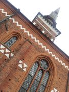
The cathedral seen from the zone DomChurch.
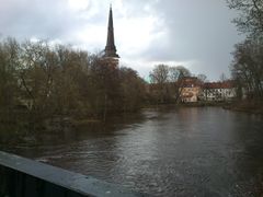
Svartån seen from the zone StonesZone.
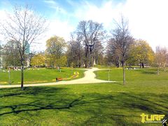
The zone FiskeLasse.
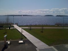
The zone SunYourZone.
The zone SilverHill.
The zone CraneBuilder.
View from the zone SquirrelZone.


