Difference between revisions of "Municipality:Vårdö"
(Added image and symbol text) |
(New zones + Structure) |
||
| Line 1: | Line 1: | ||
{{Municipality | {{Municipality | ||
|name = Vårdö | |name = Vårdö | ||
| − | |image = [[File:Vårdö. | + | |image = [[File: Vårdö, Åland.png|300px]] |
| − | |imagetext = | + | |imagetext = The [[municipality]] of Vårdö in [[Country: Finland|Finland]] |
| − | |symbol = [[ | + | |symbol = [[File: Coat of arms of Vårdö.png|70px]] |
| − | |symboltext = | + | |symboltext = Coat of arms of Vårdö |
| − | |country = [[Country:Finland|Finland]] | + | |country = [[Country: Finland|Finland]] [[File: Flag of Finland.png|x12px]] |
| − | |region = [[Region:Åland|Åland]] | + | |region = [[Region: Åland|Åland]] [[File: Flag of Åland.png|x12px]] |
| − | |numberofzones = | + | |numberofzones = 10 |
| − | |maxpph = | + | |maxpph = 10 |
| − | |updated = | + | |updated = 2021-12-30 |
}} | }} | ||
| − | '''Vårdö''' is | + | '''Vårdö''' is a [[municipality]] in the [[region]] of [[Region: Åland|Åland]] in [[Country: Finland|Finland]]. |
The municipality has a population of 444 (31 January 2019) and covers an area of 572.56 square kilometres (221.07 sq mi) of which 471.16 km2 (181.92 sq mi) is water. The population density is 4.37 inhabitants per square kilometre (11.3/sq mi). | The municipality has a population of 444 (31 January 2019) and covers an area of 572.56 square kilometres (221.07 sq mi) of which 471.16 km2 (181.92 sq mi) is water. The population density is 4.37 inhabitants per square kilometre (11.3/sq mi). | ||
| + | |||
| + | The word "vårdö" means "the guardian island". On the highest mountain of Vårdö people used to light bonfires to warn the other islands of danger. | ||
The municipality is unilingually Swedish. | The municipality is unilingually Swedish. | ||
| + | |||
| + | [[File: Åland municipalities.png|235px|thumb|left|Åland's municipalities]] | ||
| + | |||
| + | == Location == | ||
| + | Vårdö is an island municipality in the northeast of [[Region: Åland|Åland]], an autonomous territory of [[Country: Finland|Finland]]. Adjacent municipalities are [[Municipality: Kumlinge|Kumlinge]] in the east, [[Municipality: Sottunga|Sottunga]] in the southeast, [[Municipality: Föglö|Föglö]] in the south, [[Municipality: Lumparland|Lumparland]] in the southwest, [[Municipality: Sund|Sund]] in the west and [[Municipality: Saltvik|Saltvik]] in the northwest. | ||
| + | |||
| + | == Locations == | ||
| + | [[Strömsby]] is the municipality's administrative center. Strömsby is not really a "real village" but consists of parts of the villages Vargata, Lövö and Vårdö by. | ||
== Zones == | == Zones == | ||
| − | There are [https://lundkvist.com/? | + | There are [https://lundkvist.com/?country=fi®ion=177&city=V%C3%A5rd%C3%B6 ten] [[turf zones]] in Vårdö municipality, one of which is counted as a [[winner zone]]. |
| + | |||
| + | The most taken zone is [[Zone: VardoCross|VardoCross]] which is located at the [[rest area]] at the intersection of Vårdövägen, Lövövägen and Hummelviksvägen, next to St. Matthew's church (Vårdö church), in the municipality's administrative center [[Strömsby]]. | ||
| + | |||
| + | Year in parentheses indicates year of creation. | ||
| + | |||
| + | === [[File: Zontyp02.png|24px]] [[Winner zones]] === | ||
| + | * [[Zone: ChokoTime|ChokoTime]] ([[2021]]) - [[Round 136]] by [[User: Choko|Choko]]. The 10<sup>th</sup> [[turf zone]] in the municipality. | ||
| + | |||
| + | === Other zones === | ||
| + | * [[Zone: AnniMajaZone|AnniMajaZone]] ([[2021]]) | ||
| + | * [[Zone: Hummelvik|Hummelvik]] ([[2021]]) | ||
| + | * [[Zone: SandöSand|SandöSand]] ([[2015]]) | ||
| + | * [[Zone: SandösundSand|SandösundSand]] ([[2021]]) | ||
| + | * [[Zone: SimskälaBoat|SimskälaBoat]] ([[2015]]) | ||
| + | * [[Zone: SimskälaFerry|SimskälaFerry]] ([[2015]]) - The first [[turf zone]] in the municipality. | ||
| + | * [[Zone: Tällholmsvy|Tällholmsvy]] ([[2021]]) | ||
| + | * [[Zone: VardoCross|VardoCross]] ([[2015]]) | ||
| + | * [[Zone: Vattungsrevet|Vattungsrevet]] ([[2021]]) | ||
| − | + | ''Updated: 2021-12-30'' | |
| − | |||
| − | |||
| − | |||
| + | == Gallery == | ||
| + | <gallery mode="packed" heights=240px> | ||
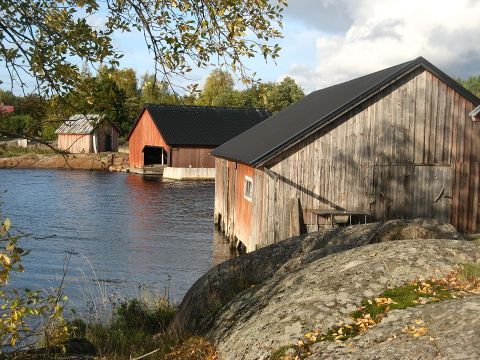
| + | Vårdö.jpg|Boathouses in Vårdö | ||
| + | </gallery> | ||
== External links == | == External links == | ||
| − | * [https://www.vardo.ax | + | * [https://www.vardo.ax Vårdö municipality webpage] |
| − | * [https://en.wikipedia.org/wiki/V%C3%A5rd%C3%B6 Vårdö | + | * [https://en.wikipedia.org/wiki/V%C3%A5rd%C3%B6 Vårdö (Wikipedia)] |
| − | * [https://lundkvist.com/? | + | * [https://lundkvist.com/?country=fi®ion=177&city=V%C3%A5rd%C3%B6 Map with all zones in Vårdö marked] |
| − | |||
| − | |||
[[Category: Municipalities]] | [[Category: Municipalities]] | ||
| − | [[Category:Vårdö| ]] | + | [[Category: Finland]] |
| + | [[Category: Åland]] | ||
| + | [[Category: Vårdö| ]] | ||
| − | [[sv: Kommun:Vårdö]] | + | [[sv: Kommun: Vårdö]] |
Latest revision as of 11:01, 30 December 2021
| Vårdö | |
|---|---|
 The municipality of Vårdö in Finland | |
 Coat of arms of Vårdö | |
| Country | Finland |
| Region | Åland |
| Number of zones | 10 |
| Maximum PPH | 10 |
| Last updated | 2021-12-30 |
Vårdö is a municipality in the region of Åland in Finland.
The municipality has a population of 444 (31 January 2019) and covers an area of 572.56 square kilometres (221.07 sq mi) of which 471.16 km2 (181.92 sq mi) is water. The population density is 4.37 inhabitants per square kilometre (11.3/sq mi).
The word "vårdö" means "the guardian island". On the highest mountain of Vårdö people used to light bonfires to warn the other islands of danger.
The municipality is unilingually Swedish.

Location[edit]
Vårdö is an island municipality in the northeast of Åland, an autonomous territory of Finland. Adjacent municipalities are Kumlinge in the east, Sottunga in the southeast, Föglö in the south, Lumparland in the southwest, Sund in the west and Saltvik in the northwest.
Locations[edit]
Strömsby is the municipality's administrative center. Strömsby is not really a "real village" but consists of parts of the villages Vargata, Lövö and Vårdö by.
Zones[edit]
There are ten turf zones in Vårdö municipality, one of which is counted as a winner zone.
The most taken zone is VardoCross which is located at the rest area at the intersection of Vårdövägen, Lövövägen and Hummelviksvägen, next to St. Matthew's church (Vårdö church), in the municipality's administrative center Strömsby.
Year in parentheses indicates year of creation.
 Winner zones[edit]
Other zones[edit]
- AnniMajaZone (2021)
- Hummelvik (2021)
- SandöSand (2015)
- SandösundSand (2021)
- SimskälaBoat (2015)
- SimskälaFerry (2015) - The first turf zone in the municipality.
- Tällholmsvy (2021)
- VardoCross (2015)
- Vattungsrevet (2021)
Updated: 2021-12-30
Gallery[edit]
Boathouses in Vårdö
