Zone:Tornberget
| Tornberget | |
|---|---|
 Foto: Peterspirea | |
 | |
| Information | |
| Difficulty | |
| Location | Haninge, Stockholm, Sweden |
| Surface | Stone, Wood |
| Created | 2016-09-01 12:28:43 |
| Trivia | The Region Stockholm´s highest point 111 meters over the sea. |
| Tornberget at Turfgame.com | |
Tornberget is a turfzone in the municipality of Haninge in the region of Stockholm in Sweden and it is counted as a summit zone.
Placement[edit]
This zone is placed by the top of the mountain Tornberget in the forest of Hanveden and the outskirts of the Tornberget nature reserve, southwest of Haninge center.
This the most taken summit zone in Turf.
Tornberget[edit]
Tornberget is a mountain in the forest area Hanveden in Haninge municipality on Södertörn. Tornberget is located next to the southeastern border of Tornberget's nature reserve and is with its 111 meters above sea level Stockholm County's highest natural mountain. On Tornberget there were previously two lookout towers, one military and one civilian, both of which were demolished in the early 1980s. In the autumn of 2017, a new lookout tower for the public was built, which was officially inaugurated on April 28, 2018.
The top of Tornberget can be reached via Tornbergsslingan, which begins and ends at the croft Paradiset in Paradisets nature reserve. The distance is about 2.5 kilometers.
The highest point of Tornberget is not on the plateau where the lookout tower is located, but on a small mountain peak about 100 meters east of the tower. There, Lantmäteriet's triangle point can be seen carved into the rock.
Gallery[edit]
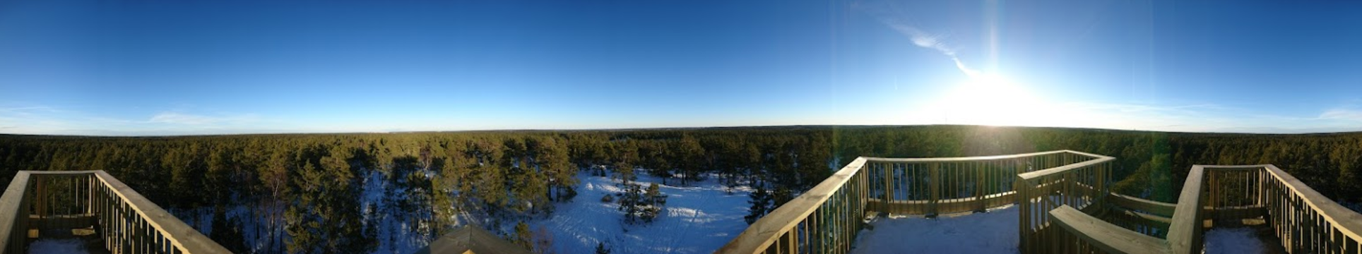
The view from the lookout tower.

Nearby zones[edit]
- Paradiset (to the north)
- VilketHörn (to the northeast)