File:Tysklands regioner.png
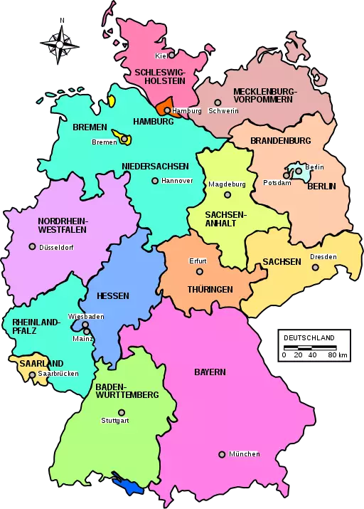
Revision as of 16:54, 27 November 2020 by Ojarnstr (talk | contribs) (Created page with "Map over the regions of Germany. Category:Regional maps Category:Countries Category:Germany")
Size of this preview: 429 × 599 pixels. Other resolutions: 172 × 240 pixels | 512 × 715 pixels.
Original file (512 × 715 pixels, file size: 305 KB, MIME type: image/png)
Map over the regions of Germany.
File history
Click on a date/time to view the file as it appeared at that time.
| Date/Time | Thumbnail | Dimensions | User | Comment | |
|---|---|---|---|---|---|
| current | 09:14, 8 June 2020 | | 512 × 715 (305 KB) |
File usage
The following page links to this file: