Difference between revisions of "Municipality:Suffolk"
AlexMathie (talk | contribs) m |
AlexMathie (talk | contribs) m (→(Image gallery)) |
||
| Line 87: | Line 87: | ||
''Updated: 2021-10-25'' | ''Updated: 2021-10-25'' | ||
| − | == | + | == Image gallery == |
<gallery> | <gallery> | ||
Old_Customs_House.jpg|CustomHouse zone | Old_Customs_House.jpg|CustomHouse zone | ||
Revision as of 22:26, 25 October 2021
| Suffolk | |
|---|---|
 | |
Suffolk arms | |
| Country | United Kingdom |
| Region | East of England |
| Number of zones | 200 |
| Maximum PPH | 200 |
| Last updated | 2021-10-19 |
Suffolk is a municipality in the region of East of England in United Kingdom. The municipality has approximately 760,000 inhabitants.
Location
The municipality is located in the mid-eastern part of East of England. Adjacent municipalities are Norfolk in the north, Essex in the south, and Cambridgeshire in the west.
Urban areas
Ipswich is the municipality's most populous town. The following is the urban areas within Suffolk that contains more than one zone:
| Town | Zones |
|---|---|
| Felixstowe | 10 |
| Ipswich | 151 |
| Southwold | 5 |
| Stowmarket | 31 |
Zones
There are 200 zones in the county of Suffolk.
| Type | Number of zones | Notes | |
|---|---|---|---|

|
Bridge | 3 | All located in Ipswich. |

|
Castle | 1 | Located in Framlingham. |

|
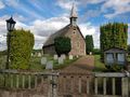
Holy | 13 | |

|
Monument | 1 | Located at the Giles statue in Ipswich. |

|
National Park | 0 | The nearest is NorfolkBroads zone in Norfolk. |

|
Train station | 4 | Located at Ipswich, Derby Road (Ipswich), Stowmarket and Felixstowe stations. |

|
Water | 0 | The nearest is NazeWater at Walton-on-the-Naze in Essex. |
The most taken zone is CustomHouse which is located on the waterfront in Ipswich.
Updated: 2021-10-25
Image gallery

CustomHouse zone
HolyAugustine zone

