Difference between revisions of "Municipality:Gothenburg"
(→24px Bridge zones: New name on a zone) |
(New zone) |
||
| Line 5: | Line 5: | ||
|symbol = [[File: Coat of arms of Gothenburg.png|60px]] | |symbol = [[File: Coat of arms of Gothenburg.png|60px]] | ||
|symboltext = Coat of arms of Gothenburg | |symboltext = Coat of arms of Gothenburg | ||
| − | |country = [[Country: Sweden|Sweden]] [[File: Flag of Sweden.png|x12px | + | |country = [[Country: Sweden|Sweden]] [[File: Flag of Sweden.png|x12px]] |
|region = [[Region: Västra Götaland|Västra Götaland]] | |region = [[Region: Västra Götaland|Västra Götaland]] | ||
| − | |numberofzones = | + | |numberofzones = 1164 |
| − | |maxpph = | + | |maxpph = 4473 |
| − | |updated = 2021- | + | |updated = 2021-09-15 |
}} | }} | ||
| Line 22: | Line 22: | ||
== Zones == | == Zones == | ||
| − | There are [https://lundkvist.com/?country=se®ion=132&city=G%C3%B6teborg | + | There are [https://lundkvist.com/?country=se®ion=132&city=G%C3%B6teborg 1164] [[turf zones]] in the municipality of Gothenburg, three of which are counted as [[winner zones]], two [[water zones]], one [[train station zone]], seven [[monument zones]], 37 [[holy zones]], 50 [[bridge zones]], five [[castle zones]] and five [[ruin zones]]. |
The most taken zone is [[Zone: QueensPark|QueensPark]] which is located on Drottningtorget (Queen's Square) in central [[Gothenburg]]. | The most taken zone is [[Zone: QueensPark|QueensPark]] which is located on Drottningtorget (Queen's Square) in central [[Gothenburg]]. | ||
Revision as of 08:26, 15 September 2021
| Gothenburg (Göteborg) | |
|---|---|
 | |
 Coat of arms of Gothenburg | |
| Country | Sweden |
| Region | Västra Götaland |
| Number of zones | 1164 |
| Maximum PPH | 4473 |
| Last updated | 2021-09-15 |
Gothenburg (Swedish: Göteborg) is a municipality in the region of Västra Götaland in Sweden. The municipality has about 583,700 inhabitants and is located in the provinces of Västergötland and Bohuslän.
The river Göta älv flows through the municipality.
Contents
Location
The municipality is mainly located in the western parts of the province Västergötland while parts of Hisingen are located in southern Bohuslän. The river Göta älv flows through the municipality, while the river Nordre älv in the north forms the border to the municipality of Kungälv. To the west, Gothenburg borders the Kattegat.
Neighboring municipalities to the municipality of Gothenburg are Kungsbacka in Halland County, Mölndal and Härryda in the former Gothenburg and Bohus County in the south, Partille in former Gothenburg and Bohus County and Lerum in former Älvsborg County in the east and Ale in former Älvsborgs county and Kungälv in the former county of Gothenburg and Bohus in the north, to which Öckerö in the west also belonged.
Zones
There are 1164 turf zones in the municipality of Gothenburg, three of which are counted as winner zones, two water zones, one train station zone, seven monument zones, 37 holy zones, 50 bridge zones, five castle zones and five ruin zones.
The most taken zone is QueensPark which is located on Drottningtorget (Queen's Square) in central Gothenburg.
Year in parentheses indicates year of creation.
 Winner zones
- Drakblomman (2018) - Round 94 by MrJokerit
- ElCamino (2014) - Round 50 by Pilgrim
- Slättavattnet (2018) - Round 96 by MrJokerit
 Water zones
 Trainstation zones
 Monument zones
- Backabranden (2019)
- Fisketorget (2016)
- GAZone (2010)
- IngoTheChamp (2017)
- Kopparmärra (2010)
- Shipside (2011)
- Sjömansfrun (2013)
 Holy zones
- AllSaintsTorg (2013)
- AngeredsKyrka (2016)
- Annedalskyrka (2018)
- AskimKyrka (2014)
- BackadalsHoly (2020)
- BackaKyrka (2013)
- Elim (2018)
- Fiskekyrkan (2011)
- FrölundaKyrka (2016)
- Gravallvar (2019)
- GraveZone (2010)
- GötaDome (2011)
- GötetsMoské (2013)
- HagaChurch (2012)
- HammraBoll (2014)
- HedgeZone (2010)
- HeligeMicke (2018) - Formerly called HeligaMicke
- HighTower (2012)
- HolyÄlvsborg (2017)
- KapellKapelle (2017)
- KviKrigsgrav (2014)
- Kyrkogången (2021)
- LundbyGamlaKa (2016)
- MastZone (2010)
- Matteus (2013)
- MissionZone (2011)
- NyaLundby (2013)
- NylöseKyrka (2014)
- OscarFredriks (2012)
- Rundpingis (2017)
- RödboKyrka (2016)
- Stampens (2012)
- StPauli (2013)
- StyrsöKyrka (2014)
- SäveKyrka (2015)
- Vasakyrkan (2014)
- Örgryte (2011)
 Bridge zones
- Amundbron (2014)
- AngerBridge (2013) - Formerly called Angerbridge
- BengtasBro (2018)
- Brudarebron (2017)
- BrunnsbosBro (2013)
- Bräckebro (2013)
- DeladSjö (2014)
- DieBrücke (2010)
- EyeshotZone (2014)
- Fiskebron (2014)
- Galtbridge (2014)
- Gamlebron (2014)
- GillaGerilla (2020)
- GolfBridge (2014)
- Gunnilsebro (2017)
- Gärdesbron (2013)
- HisingeZone (2010)
- Hisingsbron (2010) - Formerly called GötaBroZone
- HjällboC (2013)
- Högsboleden (2012)
- Kodammsbron (2017)
- Krokegårdsbro (2015)
- Kvibro (2017)
- Kvillebäcken (2014)
- Lundbytunneln (2013)
- Läckesbacken (2014)
- Lärjeleden (2014)
- Lärjestenbron (2014)
- Lärjeåbro (2014)
- MarieholmsBro (2012)
- Metallbron (2013)
- Oljebron (2015)
- PusterZone (2010)
- Ramnebron (2014)
- Rälsbron (2013)
- SannegårdsBro (2012)
- Skyrsjöbron (2019)
- Sluthyvlat (2010)
- StoraÅn (2014)
- Syrhåla (2016)
- UlleBridge (2012)
- UptownBridge (2013)
- VickanZone (2010)
- VolvoPåRäls (2016)
- Välteliden (2014)
- Walckesbron (2013) - Formerly called WalckeVidÅn
- WalkOnWater (2010)
- YttreJärnvågs (2015)
- ÖverHamnbanan (2016)
- ÖverLärjeån (2017)
 Castle zones
- KronanZone (2010)
- KränktaGötet (2019)
- Lejonfortet (2013)
- NewElfsborg (2011)
- OscarIIFort (2016)
 Ruin zones
- GamlaÄlvsborg (2017)
- BorgPåBerget (2013)
- Miklaborg (2015)
- PestEller (2016)
- VikingTomb (2012)
Other zones
Updated: 2021-07-28
Gallery
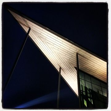
Kanalhuset at Tjôtaverket New Year's Eve 2013.
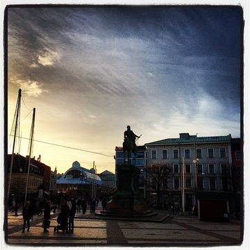
The zone Kopparmärra is located at Kungsportsplatsen.
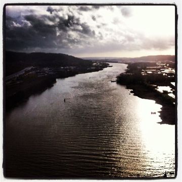
View to the south from AngerBridge on Angeredsbron, E45 to the left and E6 to the right, Göta älv flows towards Gothenburg.


